
What is Gaussian splatting? 3D Gaussian Splatting (3DGS) explained
Gaussian splatting captures a place or an object in 3D from photos or video, light and all. Its full name is 3D Gaussian Splatting, or 3DGS for short. This article covers how it works, how it differs from other 3D capture techniques, its strengths and weaknesses, how it is used, how to handle the data, and how to commission a capture, with real 3D data you can move around as you read.
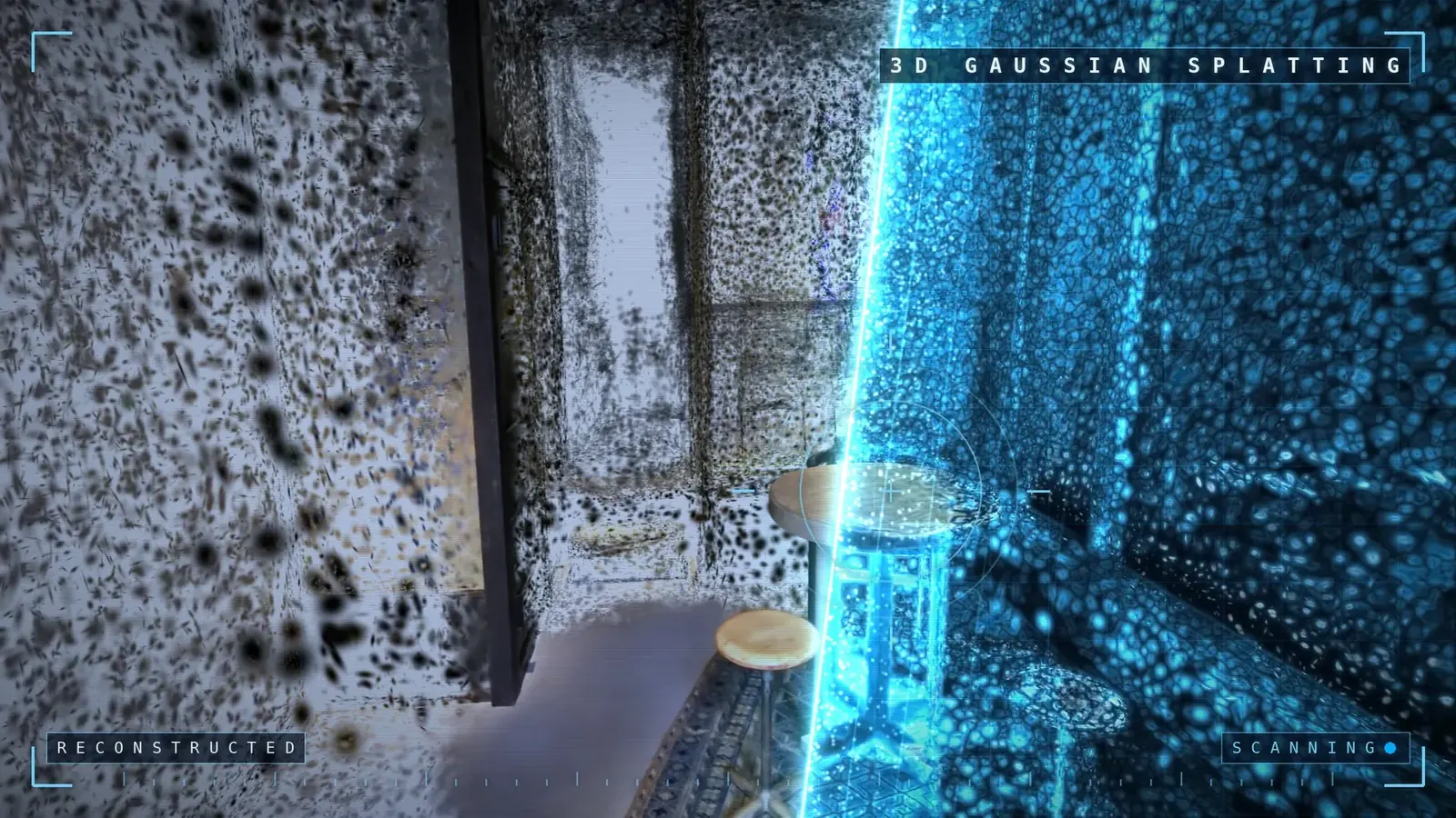
The key points in 30 seconds
- Gaussian splatting recreates a space from many photos as a collection of soft, semi-transparent blobs of color, called Gaussians. It was introduced in 2023.
- The result looks close to a photograph and can be viewed from any angle. It is strong where earlier 3D capture struggled: reflections in glass, the sheen of metal, thin branches and leaves.
- It runs in a smartphone browser. No special app is needed.
- Its weak points are guaranteed dimensional accuracy, editing after the fact, and 3D printing. These gaps are filled by pairing it with laser scanning or converting it to a mesh.
- You can try it with a smartphone app. For buildings, cultural properties, and captures you cannot afford to get wrong, hiring a professional is the safer choice.
What is Gaussian splatting?
Gaussian splatting is a technique that recreates a space in 3D from photos of a subject taken from many angles. Its formal name is 3D Gaussian Splatting, abbreviated 3DGS.
Its defining feature is that it builds no surfaces. Until now, 3D data has formed shapes by joining triangles together. Gaussian splatting instead fills the space with soft, semi-transparent blobs of color, anywhere from hundreds of thousands to millions of them. Each blob has its own position, size, orientation, color, and opacity. Layer these blobs on the screen and you get an image that looks like a photograph.
The name means exactly what it says.
- Gaussian: the shape of each blob. It is a fuzzy ellipse, dense at the center and fading smoothly toward the edges (a Gaussian distribution, in mathematical terms).
- Splatting: the way the image is drawn. Each blob is projected flat onto the screen, like a splat of paint, and the blobs are layered on top of one another.
The technique was presented in 2023 by researchers at Inria, a French research institute, and the Max Planck Institute for Informatics in Germany, at SIGGRAPH, the international conference on computer graphics (paper: 3D Gaussian Splatting for Real-Time Radiance Field Rendering). They showed that photo-quality 3D could run in real time at full HD resolution, and it took off from there.
It goes by several names: 3D Gaussian Splatting, 3DGS, Gaussian Splatting, Gaussian splats. They all refer to the same thing. The finished data is called "3DGS data" or simply "a splat."
First, try a real example
Before the explanation, try it yourself. Below is the first floor of Izutsuya, our office and gallery in Shintomicho, Tokyo, recorded with 3D Gaussian Splatting. Press the button to start loading. Then rotate the view with your finger or mouse, and move in close.
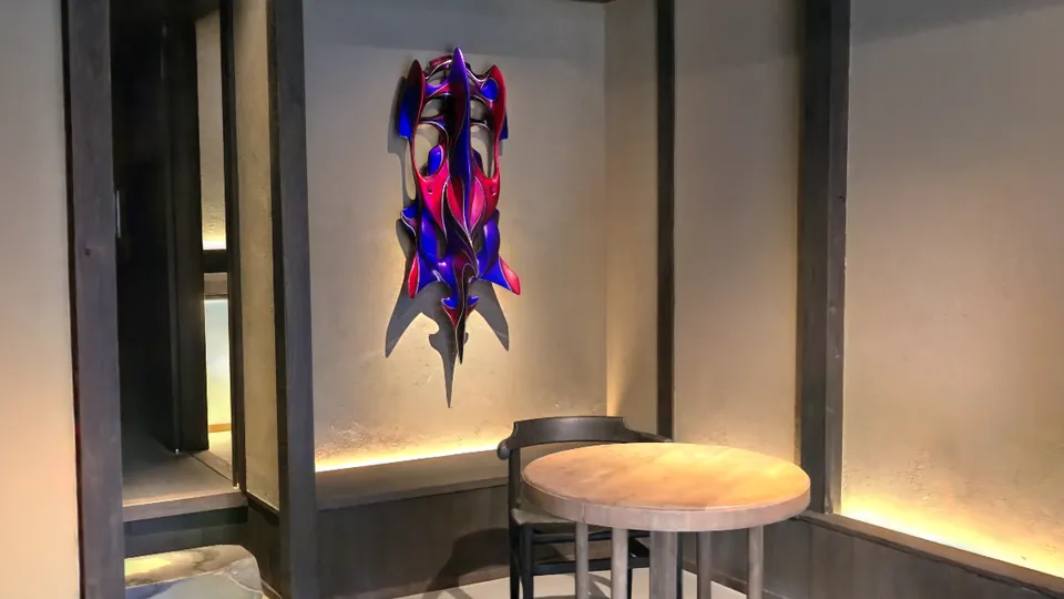
The first floor of Izutsuya, a three-story wooden building from the late Taisho era (mid-1920s). Captured on March 16, 2026, with an XGRIDS PortalCam. The data is about 25 MB in SOG format. If it does not run, open it on 3Dasset.io.
The texture of the plaster walls, the grain of the wooden pillars, the light spilling across the floor from low fixtures. Shapes hold up when you move in close, and the lighting stays natural as you rotate the view. That is the strength of drawing with blobs.
How it works: from photos to 3D
No difficult math. Here it is in four steps.
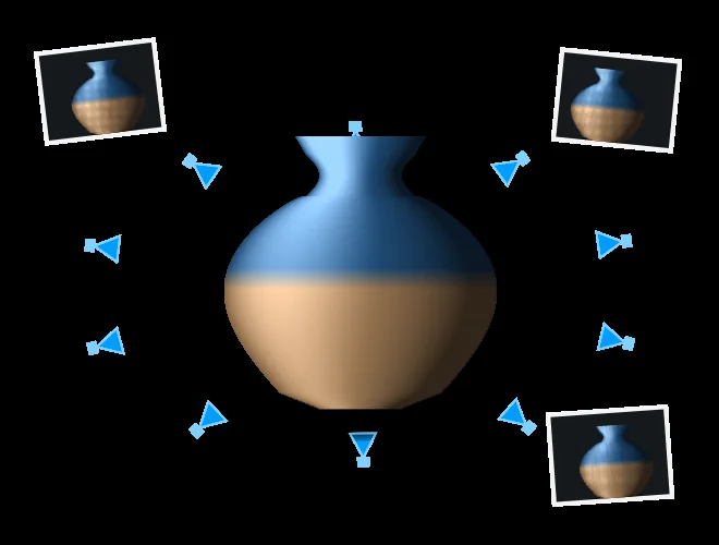
STEP 1 Capture
Take photos or video while circling the subject. The trick is to make neighboring photos overlap generously.
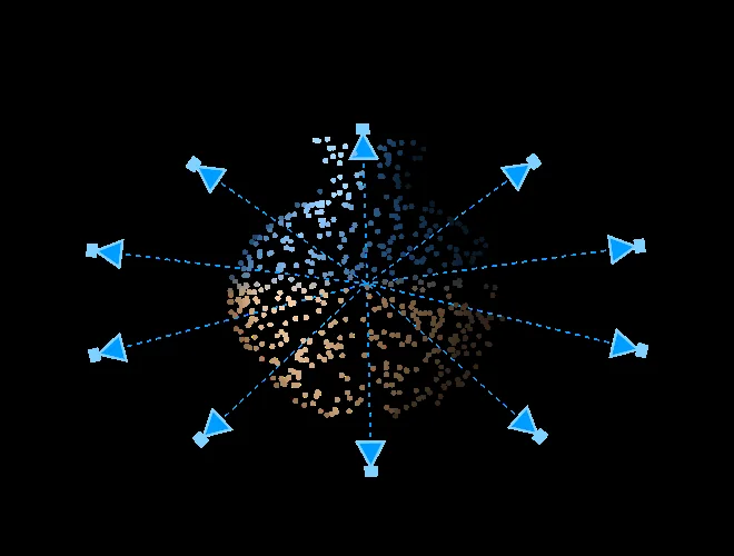
STEP 2 Work out the camera positions
The photos are compared with one another to calculate the position and direction each was taken from. This also produces a sparse set of points that traces the shape of the subject.
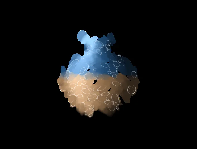
STEP 3 Grow the points into blobs
The points are replaced with soft, semi-transparent blobs of color. The image drawn from the blobs is compared with the actual photos, and the shape, color, and opacity of the blobs are adjusted tens of thousands of times to shrink the difference. Blobs are added where there are too few, and unneeded blobs are removed.
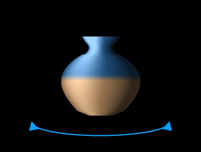
STEP 4 View from any angle
The finished blobs are layered onto the screen to match the direction you are looking from. The calculation is light, so it runs smoothly even in a browser or on a smartphone.
The key is that each blob's color is built to change with the viewing direction. A surface can gleam white from the front and look dark from the side, and the blobs remember that kind of sheen and reflection. This is why the result looks like a photograph.
This is not AI making things up
The fitting process uses machine-learning methods, but all it does is adjust the blobs until they match the photos. It never invents anything that was not photographed. The flip side: places you did not capture are not reconstructed. Where you shoot from, and how much you shoot, decides the result.
Gaussian splatting vs. photogrammetry, NeRF, and point clouds
There are other ways to turn real things into 3D. Here is the same vase represented in three ways.
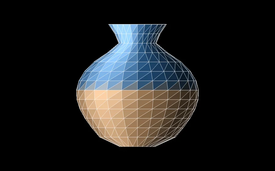
MESH Triangles
Triangles are joined into a surface, and images are wrapped over it. Building a mesh from photos is called photogrammetry.
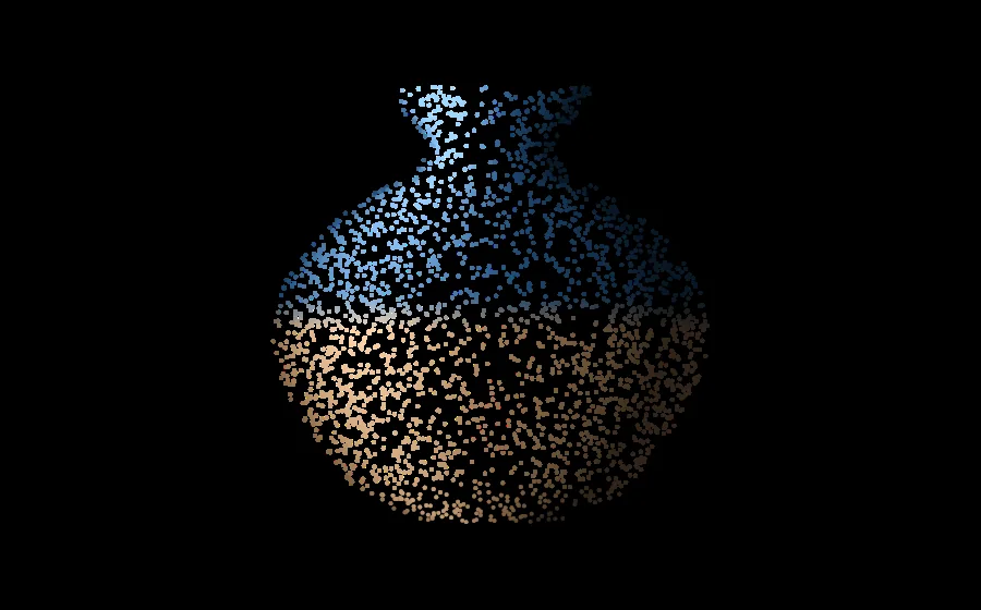
POINT CLOUD Points
A set of points, each with a position in space. It is captured with LiDAR, which measures distance by laser.
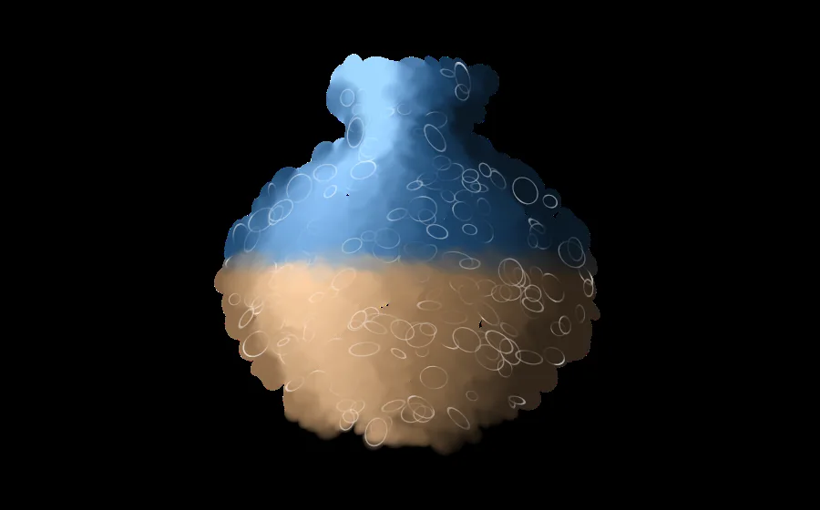
3DGS Gaussians
Soft, semi-transparent blobs of color are layered. Because no surface is built, even things with fuzzy edges can be represented.
The table below sums up what each is and is not suited to. NeRF, a technique that took off shortly before 3DGS, stores a scene inside a neural network. Ratings: ◎ excellent, ○ good, △ limited, × not suitable.
| 3DGS | Photogrammetry (mesh) | NeRF | LiDAR point cloud | |
|---|---|---|---|---|
| Made of | Semi-transparent blobs of color | Triangles and images | A neural network | Points with positions |
| Visual realism | ◎ Good with reflections, transparency, thin objects | ○ Good with well-defined surfaces | ◎ | △ Looks like a cloud of dots |
| Rendering speed | ◎ Real time in a browser | ◎ | △ Original method is slow to render | ○ |
| Dimensional accuracy | △ Not guaranteed on its own | ○ | △ | ◎ |
| Editing | △ Still maturing | ◎ The standard for CG and games | × Difficult | △ |
| 3D printing | × Needs conversion to a mesh | ◎ | × | △ |
| Best for | Showing, preserving, experiencing | Building, editing, printing | Research, film | Measuring, designing |
This is not about one method being the best. Use 3DGS to show, a mesh to build and refine, and a point cloud to measure. Choose by purpose, and combine them when needed. We do the same: 3DGS is our core, and we add photogrammetry or laser scanning depending on the subject.
Strengths and weaknesses
What it does well
- Reflections and transparency: glass, the surface of water, the sheen of metal, the gloss of lacquer. Light that changes with the viewing angle is preserved as it is.
- Thin things and soft things: branches, leaves, hair, fabric, fluffy fur. Blobs can represent what is hard to turn into surfaces.
- Large spaces: rooms, buildings, streetscapes. Capture them whole and look around at eye level, as if walking through.
- Short capture time: our office and gallery, Izutsuya, is a three-story wooden building from the late Taisho era (mid-1920s). Capturing all three floors took about 15 minutes (how we captured Izutsuya in 3DGS).
- Easy to share: just open a URL and it runs in a smartphone browser. It can also be embedded in a website.
Weaknesses and things to watch for
It is not all good news. Here are the weak points, and how we compensate for each.
| Weakness | How we compensate |
|---|---|
| Places you do not capture are not reconstructed. The back side, the top of the roof, anything hidden: if it was not shot, it becomes a hole. | Before the shoot, we decide which viewpoints matter. Outdoors, we combine ground and drone capture. Where trees or neighboring buildings create blind spots, we build the data direction by direction and merge it into one (the Isesaki Shrine example). |
| Dimensional accuracy cannot be guaranteed. Looking accurate is not the same as being accurate enough for drawings. | Where dimensions matter, we also capture a point cloud with LiDAR. A single shoot can produce the point cloud, BIM, and 3DGS together (Point cloud × BIM × 3D/4D Gaussian). |
| Anything that moves comes out blurred. Passersby, leaves swaying in the wind, and flowing water are all difficult. | We shoot when few people are around. To preserve the motion itself, we use 4D Gaussian Splatting (see below). |
| It cannot be used as is for 3D printing or in 3D content creation tools. That is because it has no surfaces. | We convert it to a mesh (GLB, STL, or OBJ). Our web service for this is available in beta (3DGS Mesh Converter). |
| The data tends to be large. For an entire building, the source data can reach several GB. | We compress it for publication. In one case, we made 10 GB of data viewable in a smartphone browser (RAD format support). |
| It depends on weather and light. Strong direct sunlight creates deep shadows and blown-out highlights. | Outdoors, we choose overcast days or times of day when the sun is not low in the sky. |
Wondering whether your building or artwork can be captured?
Tell us the subject and what you want to use the data for, and we will tell you which method fits and how the project would run. Requests for 3DGS capture alone are welcome.
What it is used for
Here is how it is used, drawing mainly on projects we have handled ourselves.
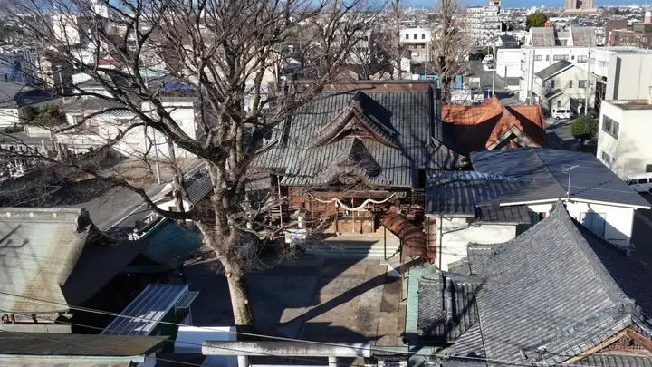
Preserving cultural properties and buildings
We record how a site looks today, in full 3D, before it is lost to disaster or decay. At Isesaki Shrine, we captured every side from the ground and by drone.
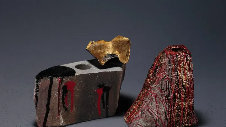
Recording crafts and artworks
The surface of stone, the gloss of lacquer, the grain of wood. We are recording in 3DGS every work in the exhibition "Hon-Komatsu Ishi no Tsuya" (The Luster of Hon-Komatsu Stone), as well as seven traditional chashaku (bamboo tea scoops). For the chashaku, we have also piloted a system that issues data on a "one physical piece = one 3D dataset" basis.
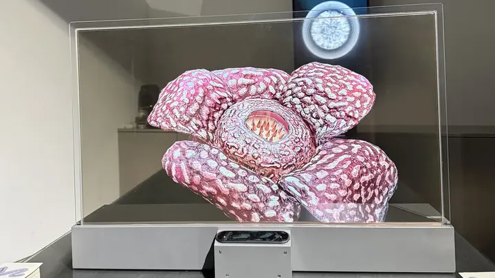
Preserving plants and natural objects
Flowers and rare plants can only be seen in season. The thinness of a leaf and the fineness of a thorn are a good match for 3DGS, which represents them with blobs. We have recorded more than 1,000 plants so far (including unpublished data).
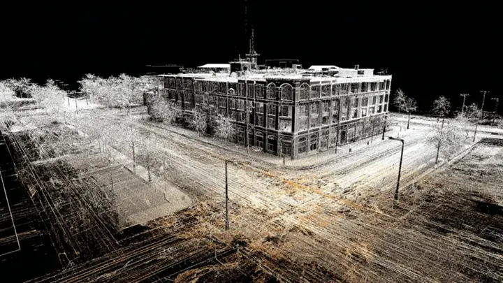
Recording and inspecting buildings and infrastructure
Point clouds for dimensions, 3DGS for appearance. A single shoot produces both the data for design and the data for presentations and PR. We are also exploring applications in infrastructure inspection.
Point cloud × BIM × 3D/4D Gaussian Applications in infrastructure inspection
Facility tours, tourism, and real estate
The 3D data can be embedded directly in an official website. Streetscapes and large buildings can be shown at eye level, as if you were walking through them. It reaches people who cannot visit in person, including those overseas.
Film, games, and XR
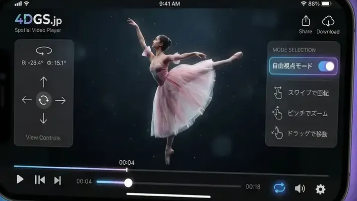
Real places can be used as they are, as backdrops or stages. Combined with 4D Gaussian Splatting, which also preserves human movement, a dance or the formal gestures of a traditional art can be replayed from any angle.
Data formats, viewing, and sharing
3DGS data comes in seven main formats. PLY is the source, and it is converted to lighter formats to suit the use.
| Format | Characteristics | Best for |
|---|---|---|
| PLY | The standard format that all the others derive from. Holds the most information | Storage, editing, source for conversion |
| Compressed PLY | PLY compressed to about 1/4 the size. Widely compatible | Web display |
| SPLAT | Very lightweight. Fast to display | Browser display |
| KSPLAT | Fast to load. Can be displayed progressively | Browser display |
| SPZ | About 1/10 the size of PLY, with visual quality intact | Distribution, apps |
| SOG | Very high compression. In one case, 101 MB of data became 8 MB | Smartphone display |
| RAD | Loads only the part being viewed, piece by piece. Handles scenes of more than 100 million blobs | Streetscapes, large structures |
There are many formats because the technology is young. Standardization is also under way. The Khronos Group, which sets international standards for 3D data, is developing an extension for handling 3DGS in the standard glTF format, and a release candidate was published in February 2026 (Khronos Group announcement).
Viewing
If you have a 3DGS file, just drag and drop it into your browser to view it. Our 3D Gaussian Splatting Universal Viewer is a free viewer that supports all seven formats above. No installation or sign-up is needed.
Sharing, publishing, and selling
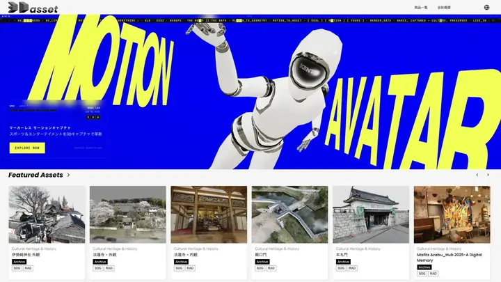
3Dasset.io, which we operate, is a 3D data platform that supports 3DGS. It handles at least 15 formats in all: the seven above (PLY, compressed PLY, SPLAT, KSPLAT, SPZ, SOG, and RAD) plus GLB, FBX, OBJ, and others.
- Publishing and embedding: share a URL and anyone can view it. You can also embed it in your own site.
- Annotations: place pins on the spots you want to show in the 3D scene and add explanations. You can also guide viewers through the highlights in order.
- Walkthrough: explore buildings and streetscapes at eye level, as if on foot. No collision setup is needed.
- Sales and storage: sell data with a license attached. Records of registered data are managed on a blockchain.
The Izutsuya data you moved around near the top of this article is also embedded from 3Dasset.io.
Try making one yourself
You can try 3DGS with nothing more than a smartphone. Doing it yourself first is the quickest way to see what it does well and what is hard.
Three kinds of tools
- Smartphone apps: everything from capture to generation happens inside the app. Options include Scaniverse, Luma AI, Polycam, and KIRI Engine. For small objects, furniture, or a corner of a room, these are plenty to have fun with.
- A camera and desktop software: photos taken with a DSLR or mirrorless camera are processed on a computer, with software such as Postshot. You can push the image quality further, but you need a high-performance graphics card.
- Dedicated scanners: handheld devices that carry multiple cameras and LiDAR. Just by walking, you can capture a large space in a short time.
Tips for a clean capture
- Shoot slowly, with overlap. Circle the subject so that each photo overlaps its neighbor by 70 to 80 percent.
- Go around three times at different heights. Eye level, looking down, and looking up.
- Keep the brightness even. Overcast days are best outdoors. When we captured a shrine on a day of strong direct sunlight, data was missing in the deep shadows.
- Keep moving things out of the shot. People, cars, swaying branches. Watch out for your own shadow too.
- Avoid camera shake and soft focus. More photos are not always better. Leave out the blurry ones.
- For glossy objects, add more angles. The more photos you have from different angles, the more cleanly reflections are preserved.
Do it yourself, or commission it?
| Good to do yourself | Better to commission |
|---|---|
| Small objects, furniture, a corner of a room | Entire buildings, shrine or temple grounds, streetscapes, high places |
| You want to try it out or evaluate it in-house | It will be published on an official site or in an exhibition |
| You can reshoot | You cannot reshoot (before demolition, an exhibit during its run, a work on loan) |
| You only need to see what it looks like | You also need dimensions, or want a mesh or drawings |
| Having the data on hand is enough | You want storage, publishing, rights management, and sales handled for you |
How to commission a capture
From here on, this article is about commissioning us, IZUTSUYA Inc. 3D Gaussian Splatting has been at the center of our 3D scanning work since 2024. From buildings and craft objects to plants and infrastructure, we choose the method to suit the subject.
Capture only, or all the way to publishing
You can commission just the 3DGS capture and data delivery. You can decide later whether to use storage, publishing, website embedding, or sales.
We match the equipment to the subject
Small objects such as craft pieces are captured with a DSLR camera and a laser 3D scanner (Revopoint MetroY Ultra). Building exteriors are captured from the ground and by drone, and interiors with a handheld scanner or 360° cameras (Insta360 X6, DJI Osmo 360). Where dimensions are needed, we use anything from our own LiDAR scanner (3DMakerpro Eagle) to our partners' industrial LiDAR systems.
How we keep costs down
After capture, many of the steps in data cleanup, optimization, and format conversion are automated with AI. In some cases we can offer prices one-tenth or less of what was typical before; for example, building data that once cost several million yen to produce now costs several hundred thousand yen.
The process
- ConsultationWe ask what you want to preserve, why, and how widely it will be published.
- Site check and capture planWe check the location, surrounding buildings and trees, and lighting conditions, then decide how to capture.
- CaptureWe use ground capture, drones, and scanners as the subject requires.
- 3D data generationWe generate the data and, as needed, merge it, reduce its size, and convert formats.
- Delivery and publishingWe hand over the data. We can also publish it on 3Dasset.io, set up embedding, and add annotations.
What to tell us when you get in touch
Knowing these six things lets us give you a rough idea of method and cost sooner. It is fine if some are still undecided.
- What to capture: a building, an interior, artworks, plants, and so on. Size and number of items too.
- Where it is: the location, and whether it is indoors or outdoors.
- What it is for: documentation, publishing on a website, exhibition, design, 3D printing, and so on.
- Who will see it: open to the public, limited to people involved, or storage only.
- Whether you need dimensional accuracy: is appearance enough, or will it be used for drawings or inspection?
- When you need it: if there is a deadline, such as a demolition or an exhibition period, give us the date.
What determines the cost
Each project is quoted individually. The cost depends mainly on these five factors.
- Size and number of subjects
- Site conditions (heights, tight spaces, hours of access)
- Accuracy required (appearance only, or dimensions too)
- Delivery formats (3DGS only, or meshes and point clouds too)
- Whether storage, publishing, and sales are included
Talk to us about a 3D Gaussian Splatting capture
Early-stage questions such as "Can this building be captured?" or "What can be done on this budget?" are welcome. A single photo of the subject helps the conversation move faster.
Capturing motion too: 4D Gaussian Splatting
3DGS records a single frozen moment. 4D Gaussian Splatting (4DGS) adds the axis of time and preserves the motion itself. A dance, the gestures of a tea ceremony, or the movement of an artisan's hands can be viewed from any angle as it plays back.
We offer a dedicated 4DGS viewer free of charge and operate 4DGS.jp, a streaming platform for 4DGS. We are also developing a renderer that generates 4DGS from video shot on a single fixed smartphone, and aim to release it publicly by the end of 2026 (development announcement).
Frequently asked questions
What is the difference between Gaussian splatting and photogrammetry?
Both create 3D from photos, but the resulting data is different. Photogrammetry builds triangles (a mesh), while Gaussian splatting arranges soft, semi-transparent blobs of color. Gaussian splatting is better at a natural look, especially for reflections, transparency, and thin objects. A mesh is better suited to editing and 3D printing.
How is Gaussian splatting different from NeRF?
NeRF is a technique that stores a scene inside a neural network. The visual quality is similar, but the original method took a long time to draw a single image. Gaussian splatting simply layers blobs onto the screen, so it displays quickly and runs in browsers and on smartphones.
Can I make a Gaussian splat with just a smartphone?
Yes. There are apps that handle everything from capture to generation. For small objects or a corner of a room, that is plenty to try it out. For entire buildings, or captures meant for publication, differences in equipment and experience tend to show, so we recommend commissioning the work.
How many photos do I need for Gaussian splatting?
It depends on the subject. As a guide, a few dozen to about 200 for a small object, and several hundred or more for a room or a building. More important than the count is that the photos overlap well and are not blurred. You can also extract frames from video.
How large are Gaussian splatting files?
In the original PLY format, a small object runs from tens to hundreds of MB, and an entire building can reach several GB. For publication, the data is converted to a lighter format. In one case, 101 MB of data became 8 MB in SOG format; in another, 10 GB of data was converted to RAD format and made viewable in a smartphone browser.
Can you take measurements from a Gaussian splat?
3DGS alone cannot guarantee the accuracy needed for drawings. When dimensions are required, we also capture a point cloud with LiDAR and use the two together. Tell us the accuracy you need when you get in touch.
Can I use it for 3D printing, or in 3D content creation tools such as Blender and Unity?
3D printing and surface-based production work require conversion to a mesh. We offer a web service that converts 3DGS data to GLB, STL, and OBJ (3DGS Mesh Converter, in beta). More and more plugins also let content creation tools load 3DGS directly.
Can I commission the capture only?
Yes. You can commission just the 3DGS capture and data delivery. If you later need storage or publishing, you can add them.
How much does a Gaussian splatting capture cost?
It depends on the size of the subject, site conditions, required accuracy, and delivery formats, so we quote each project individually. Start by telling us the subject and what you want to use it for.
Who holds the rights to the captured data?
On 3Dasset.io, rights are tied to the data holder (the issuer) and managed accordingly. For subjects with an owner or creator, such as cultural properties and artworks, the consent of the rights holder is needed before capture and publication. The scope of publication and whether the data can be sold are also decided in consultation with you.
Summary
Gaussian splatting is a technique for preserving reality in 3D just as it looks. By drawing with blobs instead of surfaces, it can capture light, texture, and fine detail. And because anyone can view it in a browser, preserving the data and getting it in front of people can be planned as one continuous process.
On the other hand, it is not good at dimensions, editing, or 3D printing. The practical approach is to combine it with point clouds and meshes to suit your goal.
If you have a building or a work you want to preserve, or a place you want to show in 3D, feel free to get in touch.
Get in touchSee our cultural heritage archiving
Related reading
The company behind this article
IZUTSUYA Inc. (Chuo-ku, Tokyo). We have been doing 3D scanning with 3D Gaussian Splatting since 2024, and operate the 3D data platform 3Dasset.io and the 4DGS streaming platform 4DGS.jp. Our official YouTube channel, "3DGS&4DGS," has passed 100,000 subscribers.